In this edition of the Learning Series, CanWaCH is excited to share the second part of our two-part series featuring the BornFyne Mobile Application project!
In the first session, we learned about using mobile applications and geographic information systems (GIS) to build partnerships in fragile settings. In this second session, we are taking a deeper dive of BornFyne’s technical elements, the team’s data journey and their approach to balancing programmatic and data strategies. We explore connections between mobile health (mHealth), geographic information systems (GIS), and local health databases. Tune into this informative conversation with BornFyne experts who discuss the health equity implications of Randomized Controlled Trials (RCTs), ethics and security of data in a conflict setting, and more.
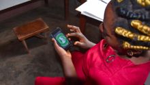
“BornFyne” is a local branded name in Cameroon, meaning safe delivery. The BornFyne Mobile Application (App) allows expectant mothers to quickly access healthcare by communicating with providers directly in an urgent care situation through their web-based platform known as the prenatal management system. This enables the ongoing monitoring of high-risk pregnancies to establish continuity of care and features family planning messages tailored to suit the local context, needs and language.
Dr. Patrick Okwen of eBASE Africa explains how the BornFyne App has synergized with the District Health Information System (DHIS2) – the global platform used to collect routine health data by community health workers and providers. BornFyne works with the DHIS2 system to provide a comprehensive picture of patient data and local health outcomes.
BornFyne App facilitates capturing data on the ‘remoteness of services’ as it maps patient data with geospatial elements. The Service Availability & Readiness Assessment (SARA) tool (developed by the WHO, adapted for Cameroon) is powered by Magpi mapping. This combination enables the SARA tool to collect satellite GPS coordinates, and then maps the availability of and quality of services in the local area. Figure 1 details the precise locations and qualitative data responses from remote community members on their use of bed nets:
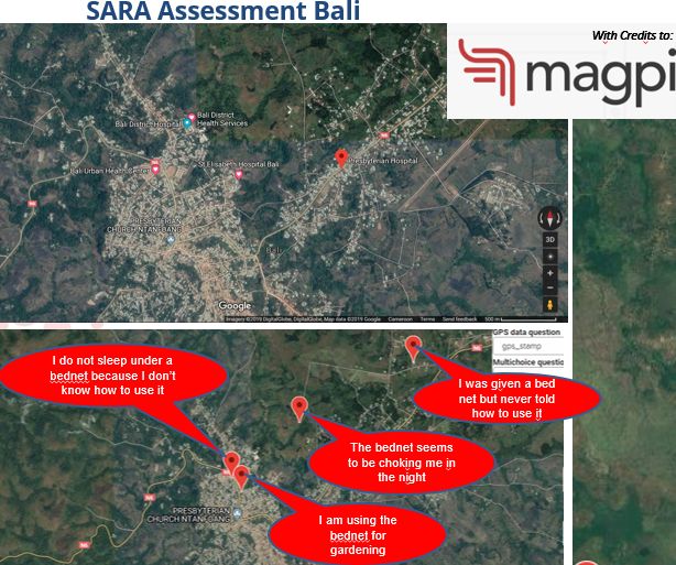
“I was given a bed net but never told how to use it.” This MagPi geo-coordinate mapping tool identifies the community response and needs at the point of data collection. This enriches the data for decision-making and allows for targeted support.
“How can we [researchers and programmers] go into areas that are considered very poor and where everyone has the same needs and then differentiate who is most vulnerable and most in need of services?” – Miriam Nkangu
Watch as Miriam Nkangu explores how they are using a Randomized Controlled Trial (RCT), the most rigorous of assessments to evaluate the effectiveness of the BornFyne App. The question remains, how do you select who will, and who will not receive a health intervention, in this case a mobile phone and access to the BornFyne App? She outlines the health equity challenges of using an RCT model in a fragile, conflict setting where the disparity is felt at a deeper level. The team has responded with community-led strategies adapted to this context to support the uptake of the RCT design. The BornFyne Project is supported by Grand Challenges Canada, funded by Global Affairs Canada and implemented in Cameroon by the WHO Collaborating Centre for Knowledge Translation and Health Technology Assessment in Health Equity at the University of Ottawa in collaboration with Effective Basic Services (eBASE) Africa and the Ministry of Public Health at the Cameroon district level.


